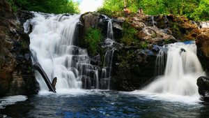
Stafford Falls Waterfall in Stafford, Washington
Stafford Falls in Washington offers a serene hiking experience that begins with a downhill trek before transitioning into a more challenging uphill climb for the last 0.4 miles. The total hike spans approximately 3.85 miles if you follow the Eastside Trail, and it's a peaceful journey with few people around even on weekends. For those using the Owyhigh Lakes Trail South Trailhead, the route includes a scenic stretch with an unmarked trail leading directly to the falls. The overall hike to Ohanapecosh and Stafford Falls is a longer, 7.3-mile adventure with an elevation gain of 1,100 feet, where wearing long pants is recommended due to the relatively untouched nature of the trail.

Map
Address
Stafford, Washington 98304
Features
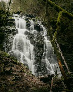
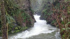
- Quiet_Peaceful
- Waterfall_Flowing
- Steep_Climb
Seasonal Guide
| Season | Best Time To See | Avg. Temp (°F) |
|---|---|---|
| ☀️ Summer | Maybe - Dense foliage partially obscures view | 75-90 |
| 🌸 Spring | Yes - Lush greenery and good weather | 50-70 |
| 🍂 Fall | Maybe - Foliage may obscure view, but pleasant weather | 45-65 |
| ❄️ Winter | Yes - Clear view, cooler weather | 30-50 |
Tips for Visitors
Preparation
As amenities may be minimal near the site, it's wise to pack essentials like water, snacks, and weather-appropriate clothing. Check local weather and trail conditions before setting out.
Navigation
Utilizing a GPS or a detailed local map is recommended, as signage in more remote areas can be limited. Apps like Google Maps or specialized hiking trail apps can be useful to ensure you're on the right path.
Respecting Nature
As with any natural site, practice Leave No Trace principles. This helps preserve the pristine condition of Stafford Falls for future visitors and protects the local ecosystem.
More Waterfalls in Washington