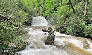
Upper Falls Waterfall in Waynesville, North Carolina
Upper Falls, located in the scenic Blue Ridge Parkway of North Carolina, offers a challenging hike that begins with a gentle descent through rhododendron-lined paths. Despite being advertised as a short 0.8-mile hike, it can take over an hour due to the strenuous trek over rocks and boulders. Although the trail is somewhat hard to follow and could benefit from more markers, the unique metamorphic rock formations at the waterfall provide a rewarding view. However, with many other remarkable waterfalls in the Pisgah Forest area, some may find the effort required for this hike to be more than what it's worth.
Map
Address
Waynesville, North Carolina 28716
Features
- Scenic_Views
- Waterfall_Flowing
- Rocky_Terrain
- Steep_Climb
Seasonal Guide
| Season | Best Time To See | Avg. Temp (°F) |
|---|---|---|
| ☀️ Summer | Maybe - Dense foliage partially obscures view | 75-90 |
| 🌸 Spring | Yes - Lush greenery and good weather | 50-70 |
| 🍂 Fall | Maybe - Foliage may obscure view, but pleasant weather | 45-65 |
| ❄️ Winter | Yes - Clear view, cooler weather | 30-50 |
Tips for Visitors
Preparation
As amenities may be minimal near the site, it's wise to pack essentials like water, snacks, and weather-appropriate clothing. Check local weather and trail conditions before setting out.
Navigation
Utilizing a GPS or a detailed local map is recommended, as signage in more remote areas can be limited. Apps like Google Maps or specialized hiking trail apps can be useful to ensure you're on the right path.
Respecting Nature
As with any natural site, practice Leave No Trace principles. This helps preserve the pristine condition of Upper Falls for future visitors and protects the local ecosystem.
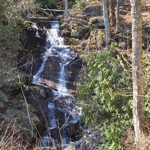
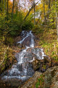
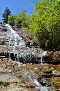
More Waterfalls in North Carolina