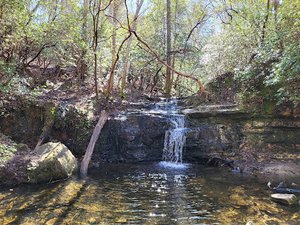
Amicalola Falls Waterfall in Atlanta, Georgia
Amicalola Falls in Georgia offers a breathtaking experience with its stunning natural beauty. The waterfall can be accessed either by a moderate 2.2-mile hike or by driving to several convenient lookout points, making it suitable for all types of visitors. For those who enjoy hiking, the trail involves 425 steps from the top to the bottom, providing a rewarding challenge with beautiful views along the way. However, visitors should be cautious of the park map's accuracy and consider alternative, easier paths not listed on the official guide.

Map
Address
Atlanta, Georgia 30534
Features
- Parking_Available
- Family_Friendly
- Scenic_Views
- Waterfall_Flowing
- Rocky_Terrain
- Steep_Climb
Seasonal Guide
| Season | Best Time To See | Avg. Temp (°F) |
|---|---|---|
| ☀️ Summer | Maybe - Dense foliage partially obscures view | 75-90 |
| 🌸 Spring | Yes - Lush greenery and good weather | 50-70 |
| 🍂 Fall | Maybe - Foliage may obscure view, but pleasant weather | 45-65 |
| ❄️ Winter | Yes - Clear view, cooler weather | 30-50 |
Tips for Visitors
Preparation
As amenities may be minimal near the site, it's wise to pack essentials like water, snacks, and weather-appropriate clothing. Check local weather and trail conditions before setting out.
Navigation
Utilizing a GPS or a detailed local map is recommended, as signage in more remote areas can be limited. Apps like Google Maps or specialized hiking trail apps can be useful to ensure you're on the right path.
Respecting Nature
As with any natural site, practice Leave No Trace principles. This helps preserve the pristine condition of Amicalola Falls for future visitors and protects the local ecosystem.
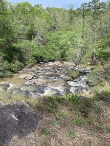
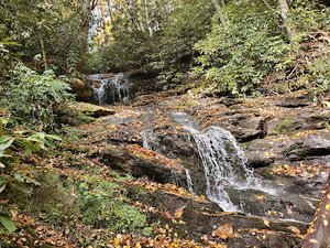
More Waterfalls in Georgia