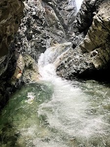
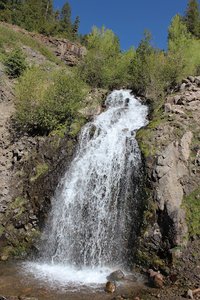
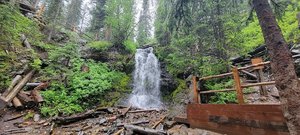
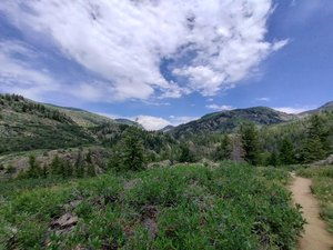
Skyline Trailhead Waterfall in Steamboat Springs, Colorado
Skyline Trailhead in Steamboat Springs, Colorado offers a charming hike with fantastic views of the nearby ski areas and Flattops. The trail itself is well-regarded, though hikers are advised to bring a map to navigate the numerous side trails. The hike includes access to the uranium mine and Fish Creek Falls, with the added convenience of free parking, albeit in a small lot. For those looking to extend their adventure, starting from this trailhead can add several miles to the journey, making it a perfect choice for burning extra calories.
Map
Address
Steamboat Springs, Colorado 80487
Features
- Parking_Available
- Family_Friendly
- Pet_Friendly
- Quiet_Peaceful
- Scenic_Views
- Waterfall_Flowing
Seasonal Guide
| Season | Best Time To See | Avg. Temp (°F) |
|---|---|---|
| ☀️ Summer | Maybe - Dense foliage partially obscures view | 75-90 |
| 🌸 Spring | Yes - Lush greenery and good weather | 50-70 |
| 🍂 Fall | Maybe - Foliage may obscure view, but pleasant weather | 45-65 |
| ❄️ Winter | Yes - Clear view, cooler weather | 30-50 |
Tips for Visitors
Preparation
As amenities may be minimal near the site, it's wise to pack essentials like water, snacks, and weather-appropriate clothing. Check local weather and trail conditions before setting out.
Navigation
Utilizing a GPS or a detailed local map is recommended, as signage in more remote areas can be limited. Apps like Google Maps or specialized hiking trail apps can be useful to ensure you're on the right path.
Respecting Nature
As with any natural site, practice Leave No Trace principles. This helps preserve the pristine condition of Skyline Trailhead for future visitors and protects the local ecosystem.
More Waterfalls in Colorado