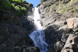
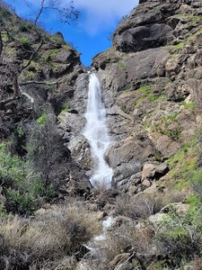
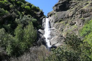
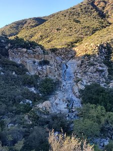
Tenaja Falls Trail head Waterfall in Murrieta, California
Tenaja Falls Trail Head in Murrieta, California, offers a short yet satisfying hike with a stunning waterfall as a reward. The trail, roughly a mile long, is relatively easy, though the drive to the trailhead can be a bit challenging. Along the way, hikers can explore small offshoot trails and enjoy the scenic beauty of a small oak grove and streams. It's advisable to visit after a good rain to ensure the falls are flowing, and be cautious of poison oak near the creek bed.
Map
Address
Forest Rte 7S02
Murrieta, California 92562
Features
- Family_Friendly
- Quiet_Peaceful
- Scenic_Views
- Wildlife_Sightings
Hours
- Monday: 5:30AM-8:30PM
- Tuesday: 5:30AM-8:30PM
- Wednesday: 5:30AM-8:30PM
- Thursday: 5:30AM-8:30PM
- Friday: 5:30AM-8:30PM
- Saturday: 5:30AM-8:30PM
- Sunday: 5:30AM-8:30PM
Seasonal Guide
| Season | Best Time To See | Avg. Temp (°F) |
|---|---|---|
| ☀️ Summer | Maybe - Dense foliage partially obscures view | 75-90 |
| 🌸 Spring | Yes - Lush greenery and good weather | 50-70 |
| 🍂 Fall | Maybe - Foliage may obscure view, but pleasant weather | 45-65 |
| ❄️ Winter | Yes - Clear view, cooler weather | 30-50 |
Tips for Visitors
Preparation
As amenities may be minimal near the site, it's wise to pack essentials like water, snacks, and weather-appropriate clothing. Check local weather and trail conditions before setting out.
Navigation
Utilizing a GPS or a detailed local map is recommended, as signage in more remote areas can be limited. Apps like Google Maps or specialized hiking trail apps can be useful to ensure you're on the right path.
Respecting Nature
As with any natural site, practice Leave No Trace principles. This helps preserve the pristine condition of Tenaja Falls Trail head for future visitors and protects the local ecosystem.
More Waterfalls in California