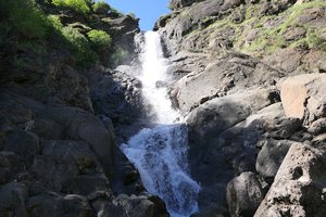
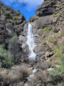
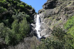
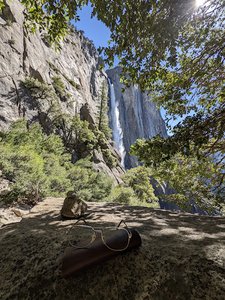
Upper Yosemite Falls Waterfall in Midpines, California
Upper Yosemite Falls in California offers a challenging yet rewarding hiking experience with stunning views of the valley. The trails can be strenuous, featuring steep switchbacks and significant elevation gain, so hikers should be well-prepared with proper gear, plenty of water, and snacks. While the full hike can take from six to over seven hours, many find the best waterfall views about two-fifths into the trail. The top offers a breathtaking panorama of the valley, but caution is advised, especially near the top, as the trails can be slippery and require careful navigation.
Map
Address
Midpines, California 95389
Features
- Parking_Available
- Quiet_Peaceful
- Scenic_Views
- Waterfall_Flowing
- Well_Marked_Trail
- Shaded_Trail
- Rocky_Terrain
- Steep_Climb
- Picnic_Area
Seasonal Guide
| Season | Best Time To See | Avg. Temp (°F) |
|---|---|---|
| ☀️ Summer | Maybe - Dense foliage partially obscures view | 75-90 |
| 🌸 Spring | Yes - Lush greenery and good weather | 50-70 |
| 🍂 Fall | Maybe - Foliage may obscure view, but pleasant weather | 45-65 |
| ❄️ Winter | Yes - Clear view, cooler weather | 30-50 |
Tips for Visitors
Preparation
As amenities may be minimal near the site, it's wise to pack essentials like water, snacks, and weather-appropriate clothing. Check local weather and trail conditions before setting out.
Navigation
Utilizing a GPS or a detailed local map is recommended, as signage in more remote areas can be limited. Apps like Google Maps or specialized hiking trail apps can be useful to ensure you're on the right path.
Respecting Nature
As with any natural site, practice Leave No Trace principles. This helps preserve the pristine condition of Upper Yosemite Falls for future visitors and protects the local ecosystem.
More Waterfalls in California