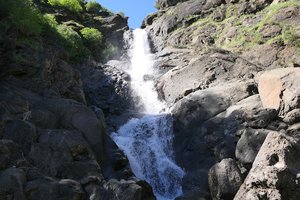
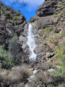
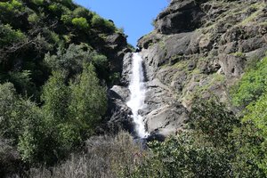
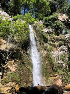
Lewis Fall trailhead Waterfall in Azusa, California
Lewis Falls Trailhead, located near Azusa, California, offers a delightful short hike nestled between the mountains. The trail presents a picturesque journey along a rushing creek, surrounded by red pine trees and big boulders, leading to a stunning waterfall with clear water. While the trail is generally easy, hikers should be prepared for some scrambling and potential wet crossings, as well as navigating around fallen trees and debris. Despite the occasional litter and graffiti, the area maintains a peaceful atmosphere, especially on weekdays, and requires a daily pass with limited parking available on the road's shoulder.
Map
Address
State Rte 39
Azusa, California 91702
Features
- Crowded
- Quiet_Peaceful
- Scenic_Views
- Waterfall_Flowing
- Shaded_Trail
- Rocky_Terrain
- Steep_Climb
Hours
- Monday: Open 24 hours
- Tuesday: Open 24 hours
- Wednesday: Open 24 hours
- Thursday: Open 24 hours
- Friday: Open 24 hours
- Saturday: Open 24 hours
- Sunday: Open 24 hours
Seasonal Guide
| Season | Best Time To See | Avg. Temp (°F) |
|---|---|---|
| ☀️ Summer | Maybe - Dense foliage partially obscures view | 75-90 |
| 🌸 Spring | Yes - Lush greenery and good weather | 50-70 |
| 🍂 Fall | Maybe - Foliage may obscure view, but pleasant weather | 45-65 |
| ❄️ Winter | Yes - Clear view, cooler weather | 30-50 |
Tips for Visitors
Preparation
As amenities may be minimal near the site, it's wise to pack essentials like water, snacks, and weather-appropriate clothing. Check local weather and trail conditions before setting out.
Navigation
Utilizing a GPS or a detailed local map is recommended, as signage in more remote areas can be limited. Apps like Google Maps or specialized hiking trail apps can be useful to ensure you're on the right path.
Respecting Nature
As with any natural site, practice Leave No Trace principles. This helps preserve the pristine condition of Lewis Fall trailhead for future visitors and protects the local ecosystem.
More Waterfalls in California