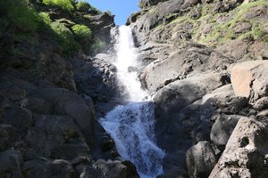
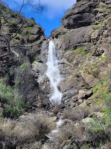
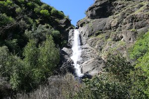
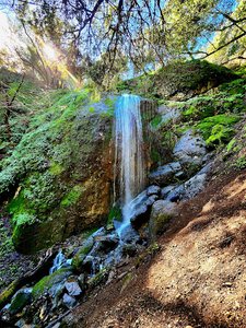
Tehan Falls Waterfall in Alameda, California
Tehan Falls, located in a remote area of California, presents a bit of a challenge to find due to unclear paths and confusing signage. Despite being on private property, the trails are approved for hiking by the owner, provided that visitors stay on the designated paths. Although Google Maps might mislead you, those who venture on the 5.2-mile hike will find it to be a good workout and may even discover a way to rappel down to the lower falls. After a rainy winter, the waterfall flows impressively, rewarding those who navigate the confusion with its natural beauty.
Map
Address
Alameda, California 94588
Features
- Waterfall_Flowing
Seasonal Guide
| Season | Best Time To See | Avg. Temp (°F) |
|---|---|---|
| ☀️ Summer | Maybe - Dense foliage partially obscures view | 75-90 |
| 🌸 Spring | Yes - Lush greenery and good weather | 50-70 |
| 🍂 Fall | Maybe - Foliage may obscure view, but pleasant weather | 45-65 |
| ❄️ Winter | Yes - Clear view, cooler weather | 30-50 |
Tips for Visitors
Preparation
As amenities may be minimal near the site, it's wise to pack essentials like water, snacks, and weather-appropriate clothing. Check local weather and trail conditions before setting out.
Navigation
Utilizing a GPS or a detailed local map is recommended, as signage in more remote areas can be limited. Apps like Google Maps or specialized hiking trail apps can be useful to ensure you're on the right path.
Respecting Nature
As with any natural site, practice Leave No Trace principles. This helps preserve the pristine condition of Tehan Falls for future visitors and protects the local ecosystem.
More Waterfalls in California