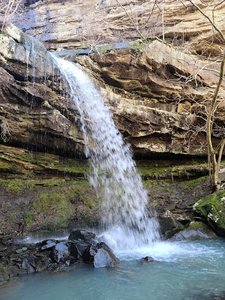
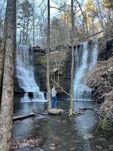
Steele Falls Trailhead Waterfall in Fifty-Six, Arkansas
Steele Falls Trailhead in Fifty-Six, Arkansas offers a rewarding hiking experience with a beautiful waterfall as the main attraction. The hike, which is about 3 miles out and back, features an easy downhill walk to the falls but requires some effort on the uphill return. While the trail is generally easy to follow, hikers should be prepared for overgrown sections with tall grass and ticks, especially in the summer months. Overall, the waterfall itself is a stunning sight, making the trek worthwhile for those who make the journey.
Map
Address
Green Mountain Rd
Fifty-Six, Arkansas 72533
Features
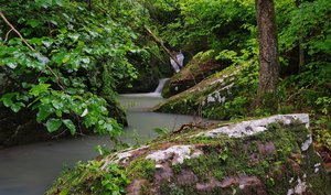
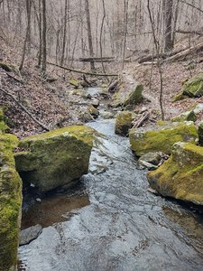
- Scenic_Views
- Wildlife_Sightings
- Waterfall_Flowing
- Steep_Climb
Seasonal Guide
| Season | Best Time To See | Avg. Temp (°F) |
|---|---|---|
| ☀️ Summer | Maybe - Dense foliage partially obscures view | 75-90 |
| 🌸 Spring | Yes - Lush greenery and good weather | 50-70 |
| 🍂 Fall | Maybe - Foliage may obscure view, but pleasant weather | 45-65 |
| ❄️ Winter | Yes - Clear view, cooler weather | 30-50 |
Tips for Visitors
Preparation
As amenities may be minimal near the site, it's wise to pack essentials like water, snacks, and weather-appropriate clothing. Check local weather and trail conditions before setting out.
Navigation
Utilizing a GPS or a detailed local map is recommended, as signage in more remote areas can be limited. Apps like Google Maps or specialized hiking trail apps can be useful to ensure you're on the right path.
Respecting Nature
As with any natural site, practice Leave No Trace principles. This helps preserve the pristine condition of Steele Falls Trailhead for future visitors and protects the local ecosystem.
More Waterfalls in Arkansas