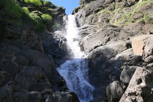
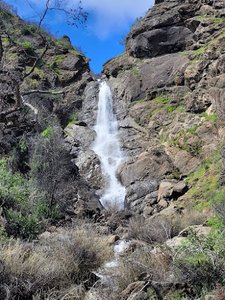
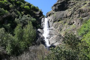
Preston Falls Trailhead Waterfall in Groveland, California
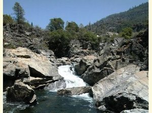
Preston Falls Trailhead in Groveland, California, offers a moderately difficult hike that spans approximately 4 miles to reach the falls. The trail is quite scenic, especially in the cooler months, with a mix of flatlands and rock formations that provide a great outdoor experience. While the path has some fallen trees and overgrowth, it remains navigable, and the constant presence of the river adds to the allure of the journey. Though the trail officially ends at a pool with a smaller waterfall, adventurous hikers can bushwhack along the river to reach the actual Preston Falls, making the trek both challenging and rewarding.
Map
Address
13555 Forest Rte 1N07
Groveland, California 95321
Features
- Scenic_Views
- Wildlife_Sightings
- Waterfall_Flowing
- Well_Marked_Trail
- Rocky_Terrain
Seasonal Guide
| Season | Best Time To See | Avg. Temp (°F) |
|---|---|---|
| ☀️ Summer | Maybe - Dense foliage partially obscures view | 75-90 |
| 🌸 Spring | Yes - Lush greenery and good weather | 50-70 |
| 🍂 Fall | Maybe - Foliage may obscure view, but pleasant weather | 45-65 |
| ❄️ Winter | Yes - Clear view, cooler weather | 30-50 |
Tips for Visitors
Preparation
As amenities may be minimal near the site, it's wise to pack essentials like water, snacks, and weather-appropriate clothing. Check local weather and trail conditions before setting out.
Navigation
Utilizing a GPS or a detailed local map is recommended, as signage in more remote areas can be limited. Apps like Google Maps or specialized hiking trail apps can be useful to ensure you're on the right path.
Respecting Nature
As with any natural site, practice Leave No Trace principles. This helps preserve the pristine condition of Preston Falls Trailhead for future visitors and protects the local ecosystem.
More Waterfalls in California